Our happy customers
the best reward!
Thank you
Forest & Environmental Studies Company

The company SYLVESTRIS OE was founded in Ioannina in 2016 and is managed by them George Anastasiou and Foteini Baltogianni . The beginning was made with two separate offices that were active in the preparation of forest & environmental studies for the past three decades.
Foteini Baltogianni started her activity in Ioannina in 1987 and Georgios Anastasiou started in Thessaloniki in 1999 and moved his office to Ioannina in 2003.
SYLVESTRIS OE has a 4th class design degree in forestry studies (category 24) and a 2nd class design degree in environmental studies (category 27).
SYLVESTRIS OE deals with the preparation of Forest and Environmental studies, preparation of Forest Maps, Objections on posted Forest Maps of the Land Registry, Photo Interpretations and Development of RES projects, while relevant consulting services are also provided.
Our team
We provide solutions utilizing the cutting edge of Technology
At the headquarters of our company is installed the appropriate logistical infrastructure, which includes powerful workstations for the use of GIS and CAD programs, File Server for the secure management of the digital file (as well as the related peripheral plotter, printer, etc.). ).
For the reception of rural data, according to the needs of each study, classic analog instruments are used, in combination with electronic GPS devices and laptops. While when a topographic survey is required, it is done in collaboration with the topographic crews of our external collaborators.
The recording of field data in databases is done in real time with applications developed by us in iSort, Bento and MS Access environments. Field data recording software and equipment have long been tested for effectiveness in a number of applications.
As part of the evaluation of our recording equipment, the nominal accuracy has been checked for GPS devices based on manufacturer specifications, in relation to the actual accuracy, ie the accuracy achieved in the field, performing a number of measurements in parallel with high-precision topographic satellite receivers. These devices have been tested for the reliability of the data they provide, in previous work we have performed in a variety of weather and environmental conditions. The control of accuracy and reliability of the various GPS devices that we have, was done in the context of our needs for the elaboration of studies that we undertook in the past and continue to undertake and concern cadastral, cartographic and topographic works in combination with GIS applications.
For both the company and its members, the experience gained is great, as one can see in our research project. An important object of our work in recent years is the elaboration of forest road studies and environmental studies for wind farms as well as the compilation of forest maps within the national cadastre.
Objects on the posted forest maps have been a special subject. We have supported a number of objections in land and island areas of Greece, from the submission of the objection, to the photo interpretation and the support to the objection examination committees (EPEA).
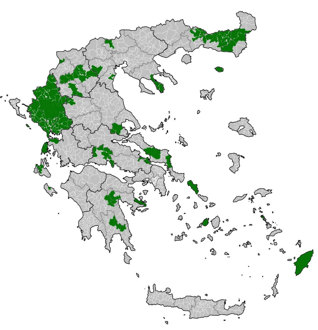
With the posting of the Forest Maps in 2017 within the framework of the National Land Registry, we dealt with a number of Objections on the posted Forest Maps in Ioannina, Thesprotia, Evia, Attica and the Cyclades. In 2018 we participated in the study group for the preparation of the Forest Map in the prefectures of Rodopi and Xanthi. With the gained experience we have prepared the ground for supporting objections to the Forest Maps, the posting of which began in January 2021.
Our research project
is a guarantee of our effectiveness.
In our long professional career, individuals, companies, local government and public bodies have trusted us.
We take every job with the same seriousness, whether it is a large company or an individual.


